
See a Map of the Exact Path of the Portage Tornado
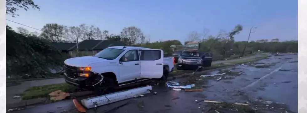
Two tornadoes were confirmed to have touched down in the Southwest Michigan city of Portage Tuesday evening (May 8, 2024). With damage and an intensity the Kalamazoo area had not seen since 1980, the Portage tornado will go down in Michigan weather lore.
This map shows the path the twister took across the city based on damage reports.
Note - as of this publication the National Weather Service has not yet issued a final report on the tornado's magnitude.
The map, reading from left to right:
The first X marks the spot where the tornado crossed US 131. Just south of the Centre Avenue exit, trees are shorn off and bent. The damage is clearly visible to drivers on the expressway.
The tornado worked its way northeast crossing over or along Centre Ave and causing damage again at the intersection with Oakland Drive - the second X. This was the area of a strip mall Pizza Hut where employees sought refuge in a walk-in freezer.
Continuing northeast, this is where the bulk of the residential damage was done in Portage - the neighborhood east of Oakland, west of Westnedge and north Oakland show as the 3rd X along Schuring Avenue.
READ MORE: Doorbell Cam Footage Shows the Immense Power of the Portage Tornado
The 4th X is where the twister crossed Westnedge Avenue - the busiest retail and dining strip in the Kalamazoo area. Two plazas saw damage - one containing Gordon Food Service, Wings Etc. and Los Amigos the other with a Main Street Pub, Jimmy John's and Biggby Coffee.
The next X on the map, just south of the Kalamazoo airport is the location of the Fed Ex facility that suffered extensive damage and had workers trapped for a time before they were safely evacuated.

The final X on the map in the upper-right hand corner shows the location of Pavilion Estates mobile home park. Just east of the Portage city limits in Pavilion Township, the complex saw over 150 homes destroyed with some injury but non appeared life threatening.
Tornado Damage in Southwest Michigan on May 7th, 2024
LOOK: The most expensive weather and climate disasters in recent decades
Gallery Credit: KATELYN LEBOFF
More From Magic 104.9


