

Why Does Google Earth Show A Jet Airliner In West Michigan’s Lake Barlow?
Google Earth has published a photo of a mysterious airplane in Lake Barlow, near Middleville. WTF?
If You've Been To Camp Manitoulin, You're Familiar With Lake Barlow
The long-time YMCA camp has occupied the northern shores of Lake Barlow for years, and as a camper, you've probably crossed that lake many times. And yet, this aircraft has never been seen until now.
According to a Google Earth screenshot posted to the Facebook Group 'Grand Rapids Informed' by Jamie So, what appears to be a full-size commercial jet airliner is either floating along the surface or is barely sunk in the lake, just beyond where Lake Barlow Road turns into Arhana Crest Drive, just south of Camp Manitoulin.
When You Zoom In, It's A Southwest Airlines Jet
When you saunter over to Google Earth (and isn't that what we do on the internet, 'saunter'), you can zoom in close on the plane, where it's clearly marked with the Southwest Airlines logo.
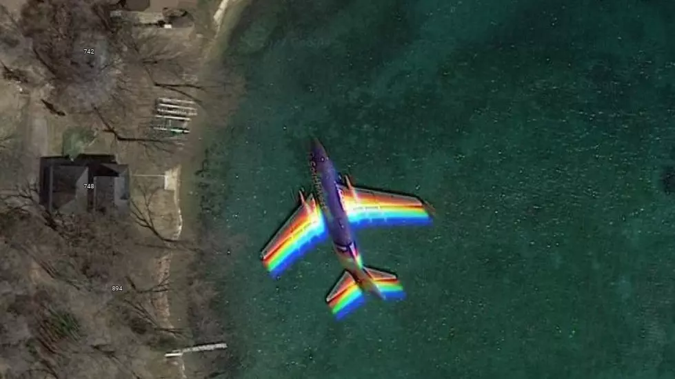
Barlow Lake is directly due south of Gerald R. Ford Airport, so did the satellite camera just inadvertently snap a shot of a commercial airliner lining up to land?
That appears to be the case as an astute observer in the comments section of So's post says, you can literally track the jet on a northwest path to GRR. Here's another photo of it over farmland just northwest of the lake...

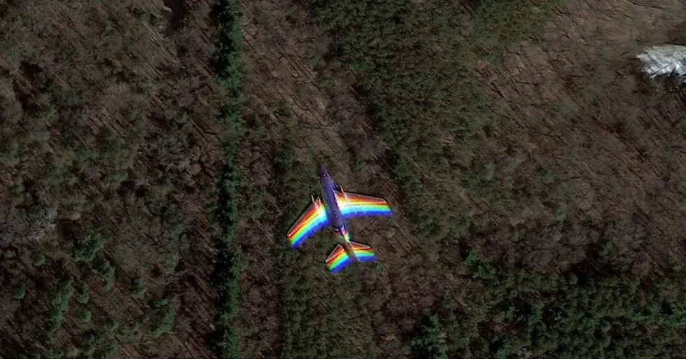
And another over some forest...
Eventually, you lose track of the jet near the FOX 17 TV tower along Patterson Road.
I assume it landed safely. I think I would've heard if it didn't.
You can follow the jet's flight path starting here.
Vintage Michigan Airports
More From Magic 104.9